Conflict Map: Identifying Risk, Building Harmony
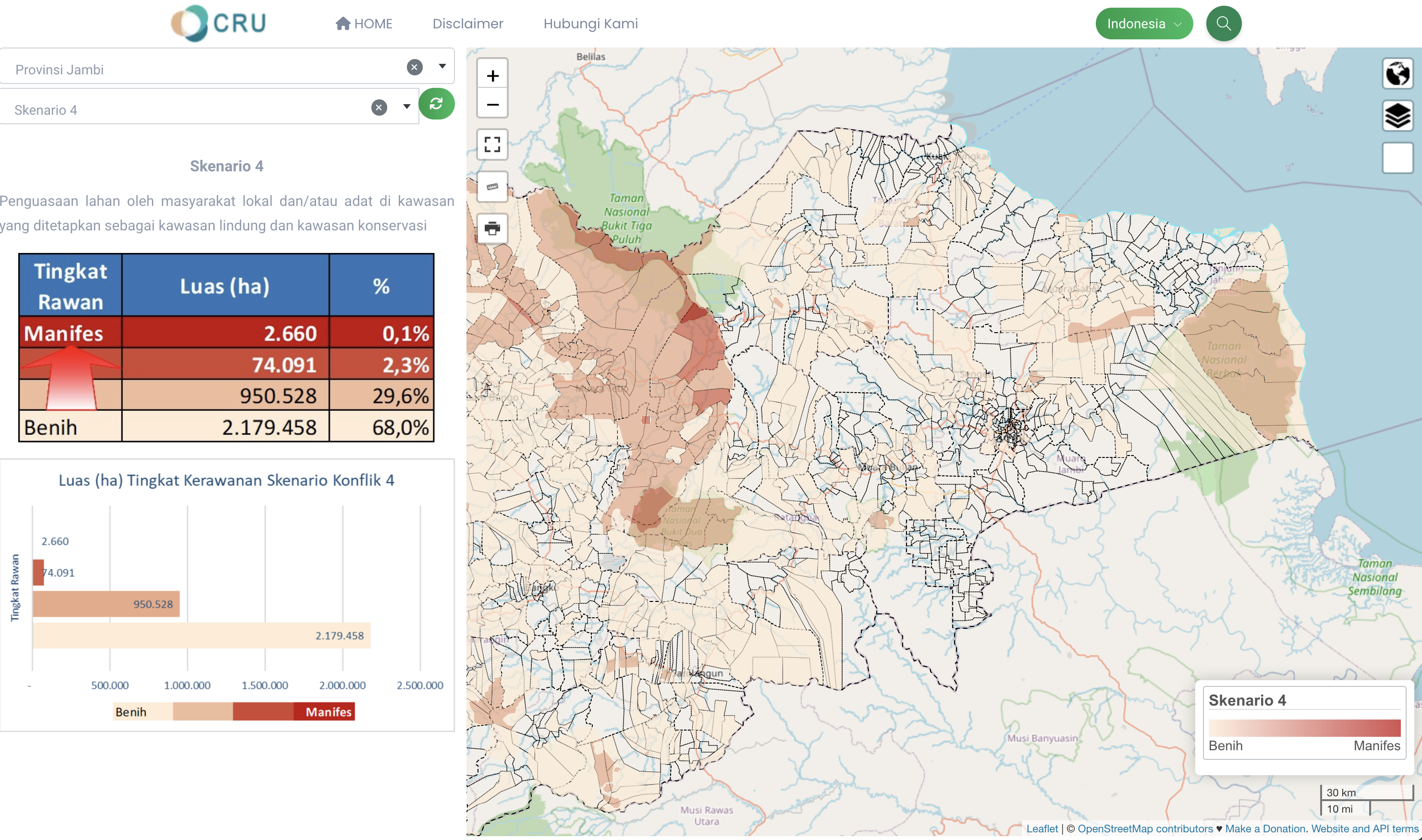
The Indicative Land and Natural Resources Conflict Prone Map enables the identification of areas susceptible to conflict concerning land and natural resource utilization. The data produced from this map will assist regional leaders, government officials at both the national and regional levels, and executives and managers from the private sector in making decisions pertaining to development planning and investments.
The conflict vulnerability assessment is based on several parameters such as population density, land type, accessibility, and past history of conflict. The map utilises various basic spatial information such as Administrative Boundary Maps, Topographic Maps, and others for more in-depth analysis. Through this approach, it is hoped that development and investment initiatives can reduce the risk of land and natural resource conflicts and promote sustainable and inclusive development in Indonesia.